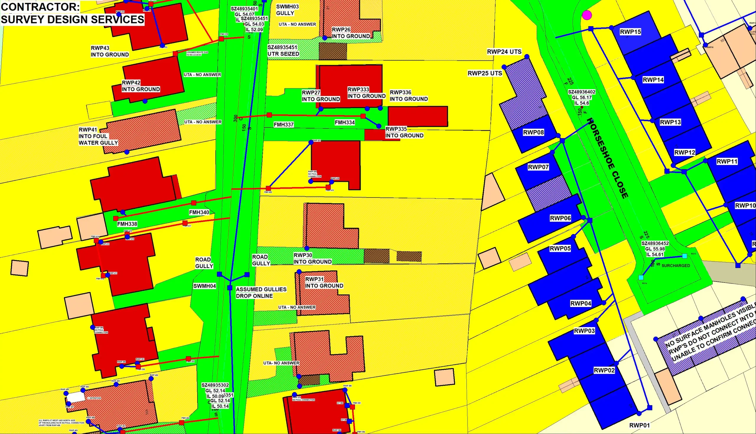
Identifying connections between rain water pipes and gullies with the foul water system assisting with producing calibrated hydraulic models.
A vital solution for surface rainwater drainage
Impermeable area studies or contributing areas surveys (CAS) identify where rainwater runoff from hard-standing areas, enters the draining system and how sewer networks perform during periods of rainfall.
What are Impermeable Area Studies?
As surveyors, we’ll investigate the impacts on the foul water and the stormwater system and how these two waters mix, such as foul sewage entering the stormwater system and causing pollution. These surveys identify the connections between rain water pipes and gullies with the foul water system assisting with producing calibrated hydraulic models.
As a vital solution for surface rainwater drainage, impermeable area surveys create an understanding of roof drainage, road surfaces and other impermeable areas to tackle flood management and a sufficient sewer network.

When do you need an Impermeable Area Study?
Rainwater can have detrimental effects on sewage networks if not monitored regularly. As it enters the foul sewer network, the water can cause excessive flows in pumping stations and water treatment works, causing sewage to overflow into streams or residential properties nearby causing pollution.
Conducting an impermeable area survey creates an understanding of the drainage of road surfaces, concrete, roofs and other impermeable areas.
We’ll help reduce the stormwater flows by identifying where stormwater sewers are separate from foul and if they combine. We use various techniques to determine where the rainfall drains, such as dye tracing, CCTV surveying and sound testing, and pinpointing stormwater connections in the foul network.
This data can also be utilised for the design and planning of SuDS schemes
How does an Impermeable Area Study work?
We survey the positions of highway storm drains and road gullies, verifying that they run to a storm sewer system and not the foul drainage network, using various techniques, such as CCTV surveying or sonde tracing. We share the study results with the client in a digitalised drawing format, which can be presented as a CAD drawing, GIS data such as Mapinfo .tab or Infoworks.
We work with public and private clients who deal with infrastructure and flood management and require a survey to ensure the correct use of drainage, preventing environmental damage.
Start a conversation with us today
Get a Impermeable Area Study estimate by contacting our friendly team today.
- Surveying since 1988
- Simple enquiry form
- Experienced team
Get SDS in for an Impermeable Area Study
At SDS, we’re a long-standing, dedicated surveying business, delivering our services to private and public sectors across Kent and beyond. We specialise in impermeable area studies, helping identify how sewer networks perform during periods of rainfall.
Whether you’re concerned about drainage problems or the sewer network, we focus on delivering quality and reliable services using the latest surveying technology.
For more information about our surveying services or to book your impermeable area survey, contact our team today.


